

If your agency or firm runs a vehicle-mounted mobile LiDAR system, you may already have everything you need for a complete sidewalk inventory. DeepWalk Drive works with leading mobile mapping systems from Trimble, Leica, and RIEGL, turning point clouds into access and condition data for every panel and ramp in the system. Drive also has a two-way sync with Esri ArcGIS, so a change made in either system shows up in the other.
This guide covers which mobile LiDAR sensors are compatible with DeepWalk, how existing roadway scans can be reused for sidewalk inspections, and what to do if your sensor is not on the list.
Mobile LiDAR sidewalk mapping uses laser scanners mounted on a vehicle to capture a dense 3D point cloud of the public right of way while driving at normal speeds. DeepWalk then processes that data to measure the sidewalk features that are important for ADA transition plans, capital improvement plans, and condition assessments.
Key measurements include:
See all 58 fields captured in our GIS Mapping files.
See how we calculate scoring in our Scoring Algorithm Blog.
Compared with tape measures, levels, and clipboards, a vehicle-based scan covers entire networks quickly and keeps field crews out of traffic. The results feed directly into improvement plans, work orders, and existing GIS systems.
DeepWalk Drive currently supports ten vehicle-mounted mobile mapping systems across three manufacturers. Two Trimble systems are recommended; the rest are fully supported.
The Trimble MX90 and MX9 are DeepWalk's recommended sensors for sidewalk mapping. Both combine laser scanning with multiple cameras on a single vehicle mount, making them a strong fit for agencies starting a new citywide sidewalk inventory.
The Trimble MX60 Series and MX50 are supported for DeepWalk processing. Teams already running these systems for roadway or asset surveys can add sidewalk deliverables without new hardware.
DeepWalk supports four Leica Pegasus models: the TRK500 Evo, TRK700 Evo, TRK500 Neo, and TRK700 Neo. Leica users can send new or archived scans for sidewalk analysis.
The RIEGL VMX-2HA and VMX-3HA high-accuracy mobile mapping systems are both supported, so firms using RIEGL for corridor surveys can extend that work into pedestrian accessibility data.
DeepWalk processes both new collections and existing mobile LiDAR scans from past roadway and sidewalk projects. If your city or firm has scanned its streets in recent years, the sidewalks were likely captured too, sitting unused in the point cloud.
Reprocessing archived scans can give you a sidewalk condition inventory without sending a vehicle back out. That makes it a fast, low-cost way to start a condition assessment or update an existing transition plan. Contact DeepWalk to process existing data.
DeepWalk also supports mobile mapping systems comparable to the ones listed above. If you run a different vehicle-mounted LiDAR scanner, reach out and the team will confirm compatibility.
No mobile LiDAR system at all? DeepWalk Phone uses LiDAR-enabled iPhones for walking inspections, and configured phones are available through the phone rental program.
Whether you own a compatible sensor, have archived scan data, or have a project coming up, DeepWalk can turn mobile LiDAR into actionable sidewalk data. Schedule a demo to get started.
Map the current sidewalk mileage in your city, town, neighborhood, or custom area. Our new mileage tool pulls accurate sidewalk information, allowing you to plan efficiently, budget effectively, and determine the amount of data collectors for your project. The data is sourced from OpenStreetMap, a free, collaborative mapping platform built and maintained by contributors worldwide.
Get A Free Mileage Estimate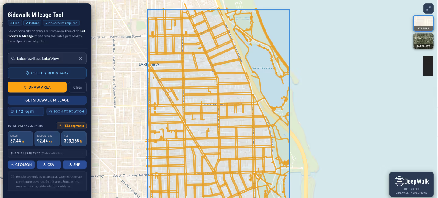

DeepWalk is the sidewalk inspection solution trusted by 130+ municipalities and consultants nationwide.
© 2026 DeepWalk Research, Inc.
All rights reserved.