
DeepWalk's AutoReport is an automatically generated document summarizing a scan's inspection results, giving you and other important stakeholders an overview of scan-specific accessibility status.
See Sample Reports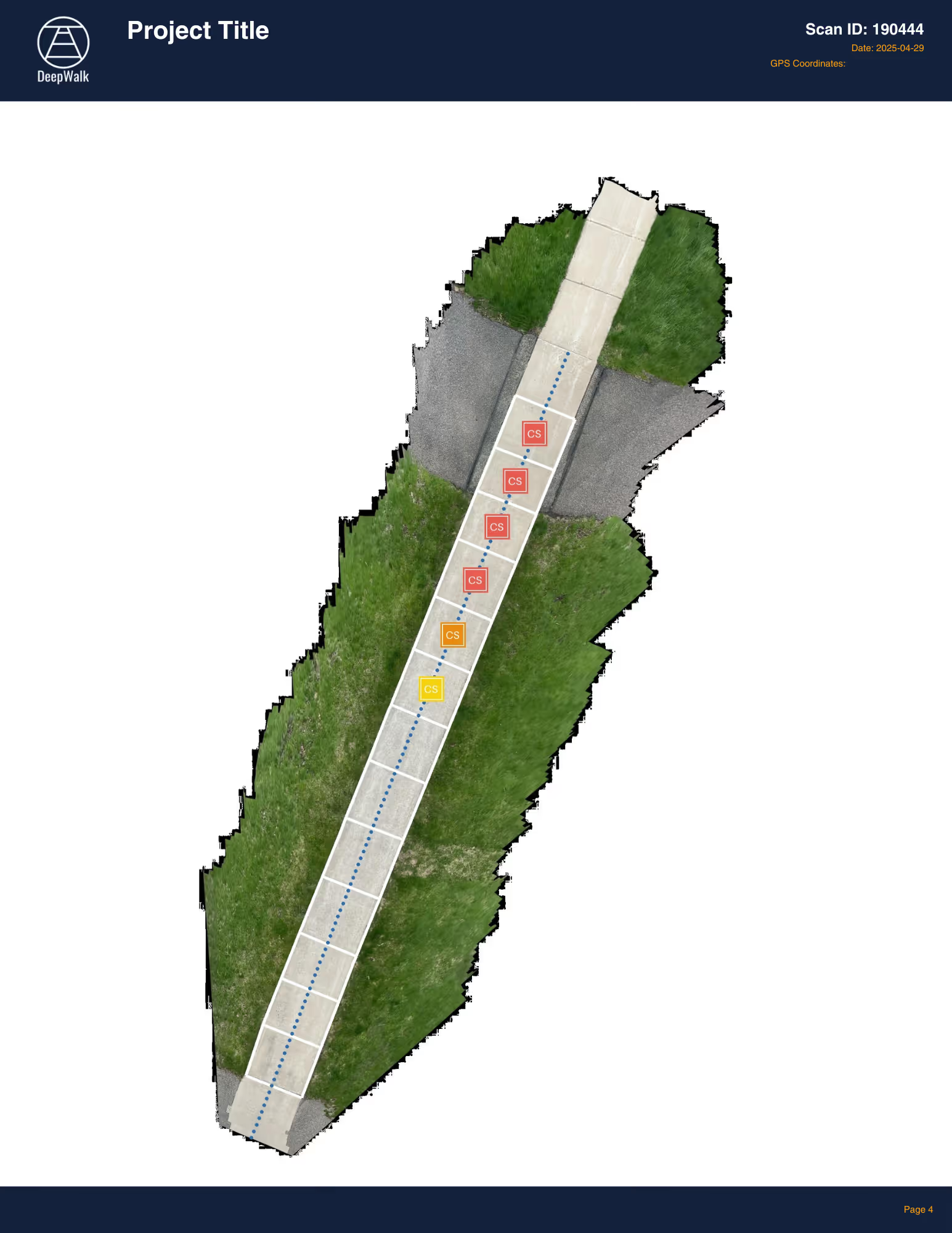
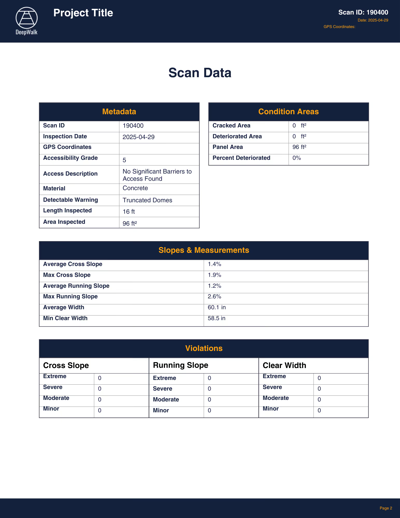
The scan metadata includes high level information about the scan, including...
- Scan ID
- Data collector
- Project name
- GPS coordinates
- Map location
- Collection Date
The inspection summary reflects the current status of the scanned region, including...
- Access score
- Condition score
- Deteriorated area
- Vertical displacements
- Cross slope violations
- Running slope violations
- Clear width violations
- Detectable warning surface status
- Material type
- Scan type
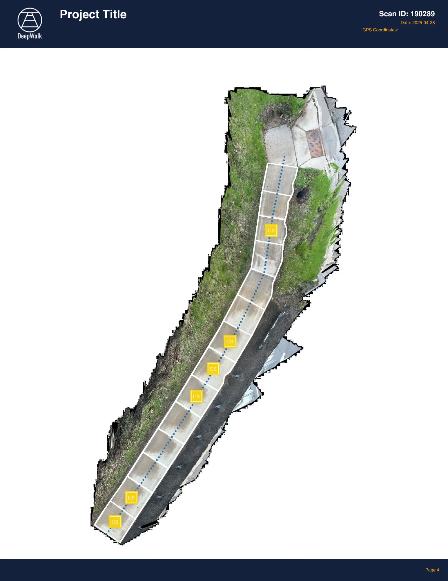
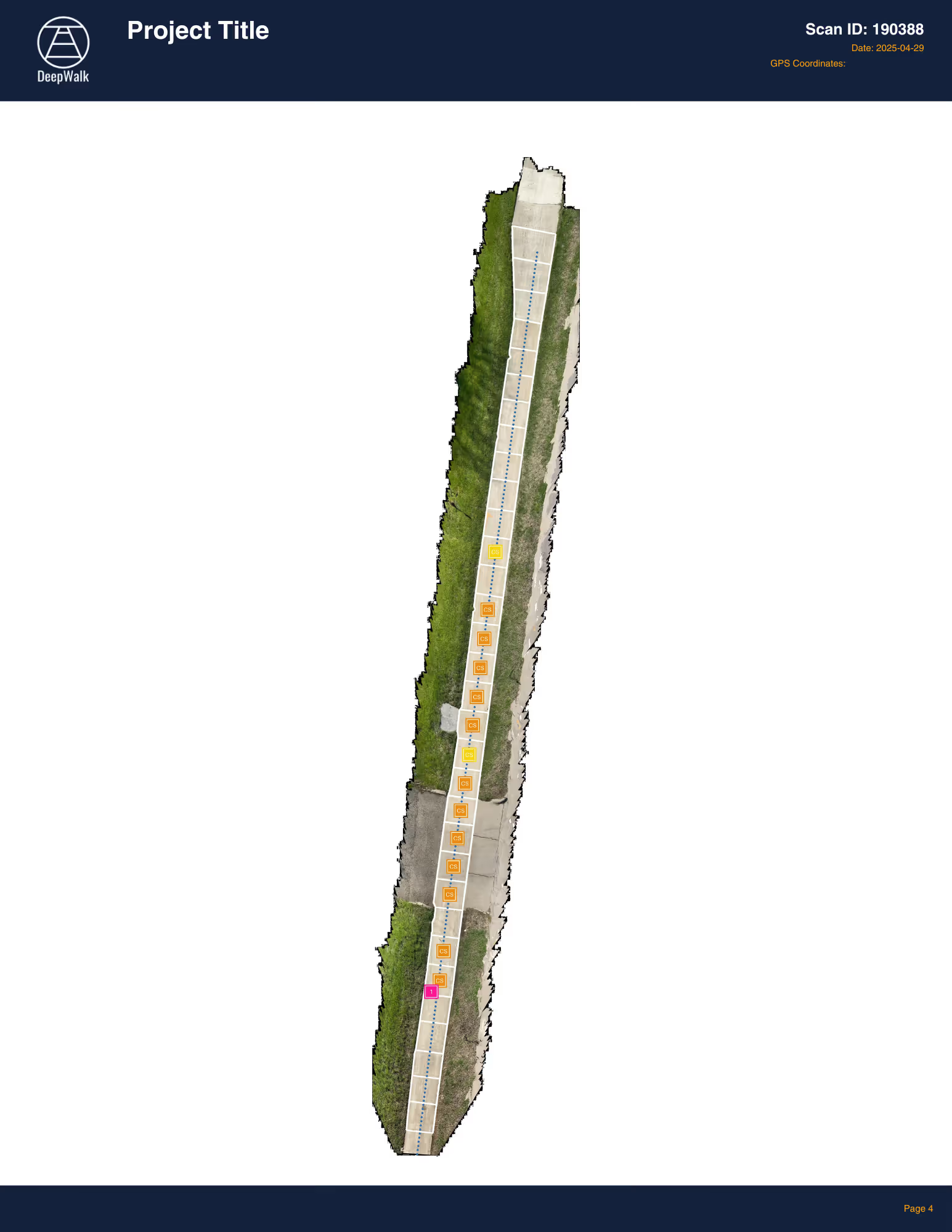
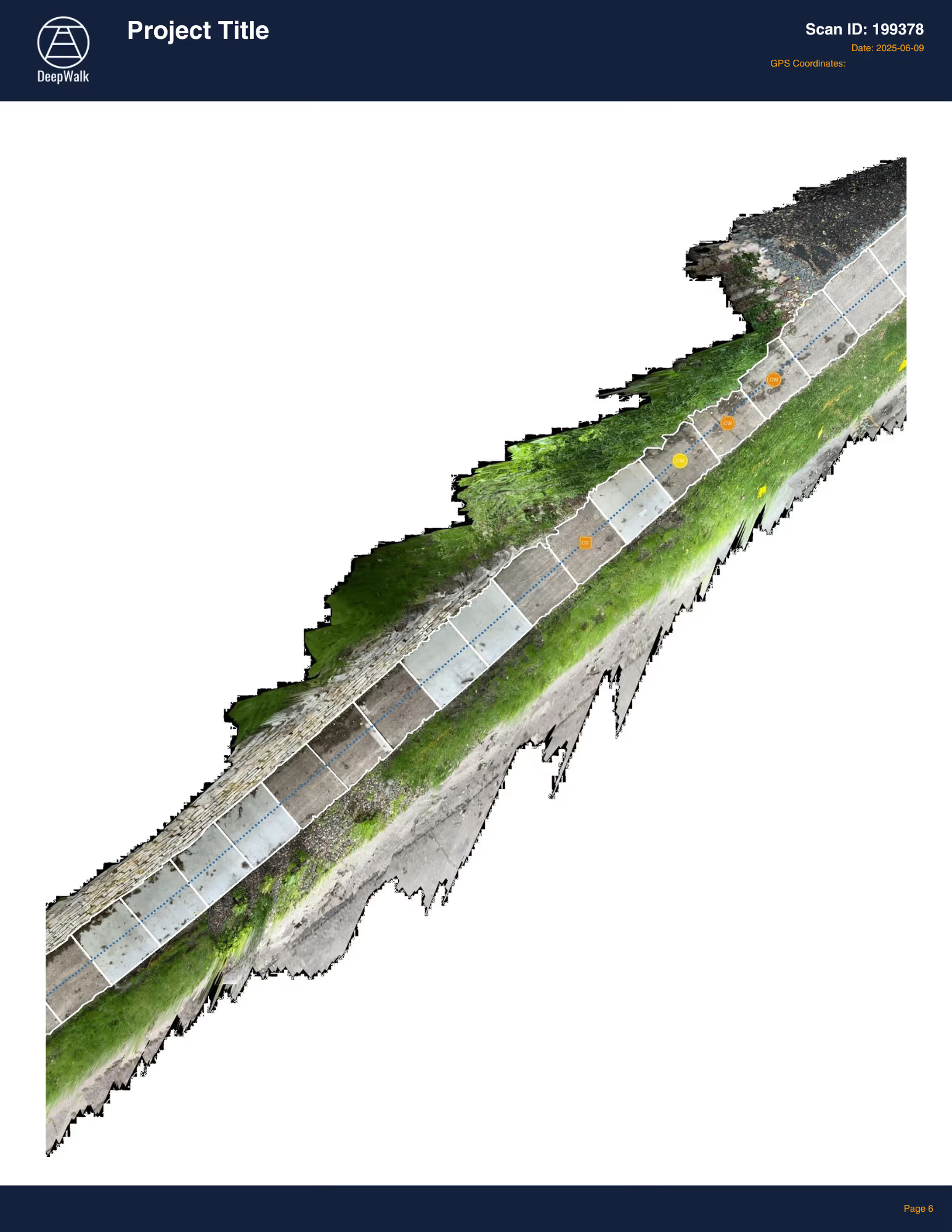
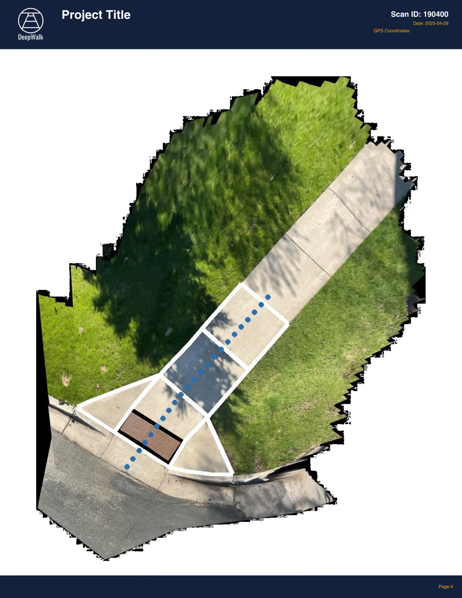
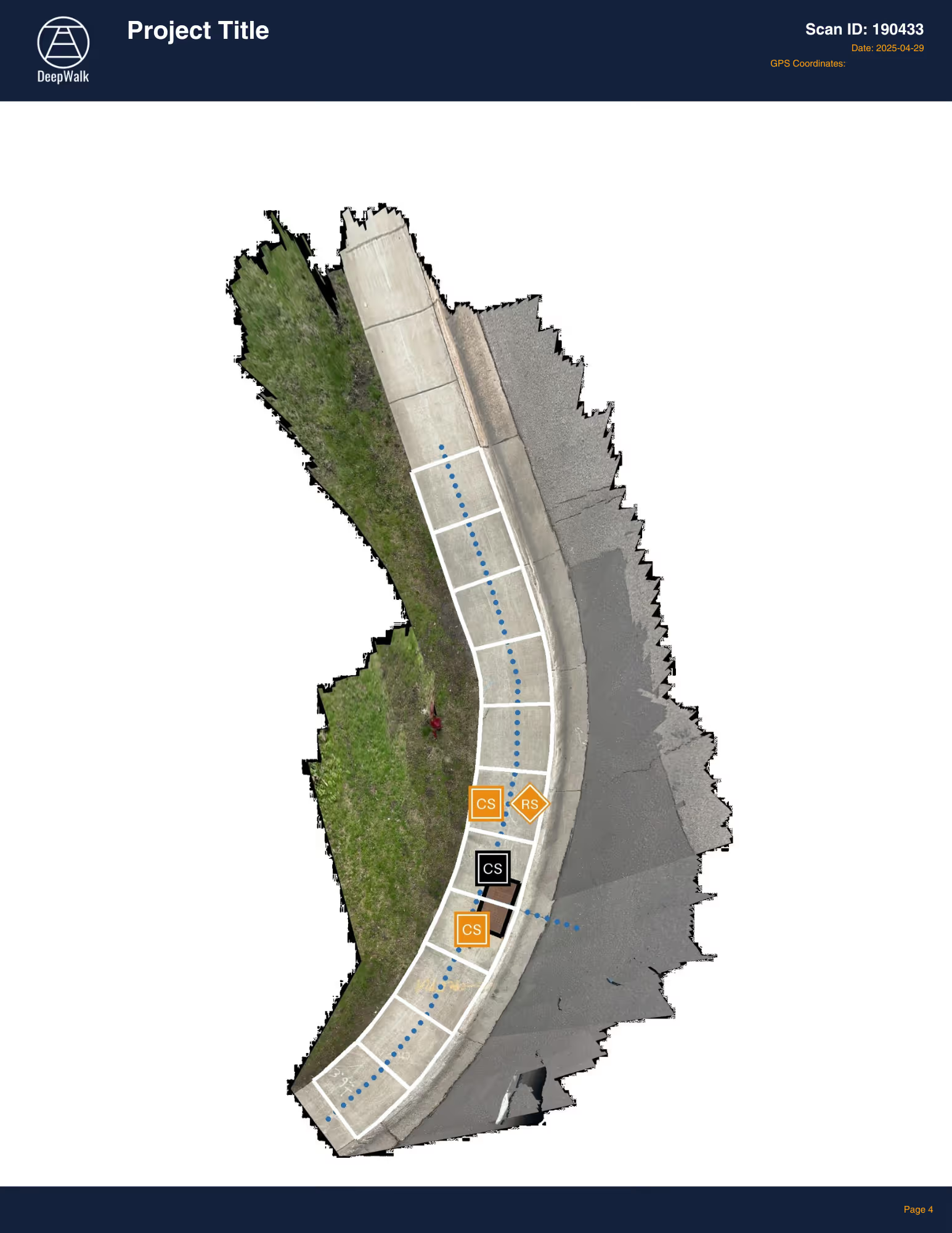
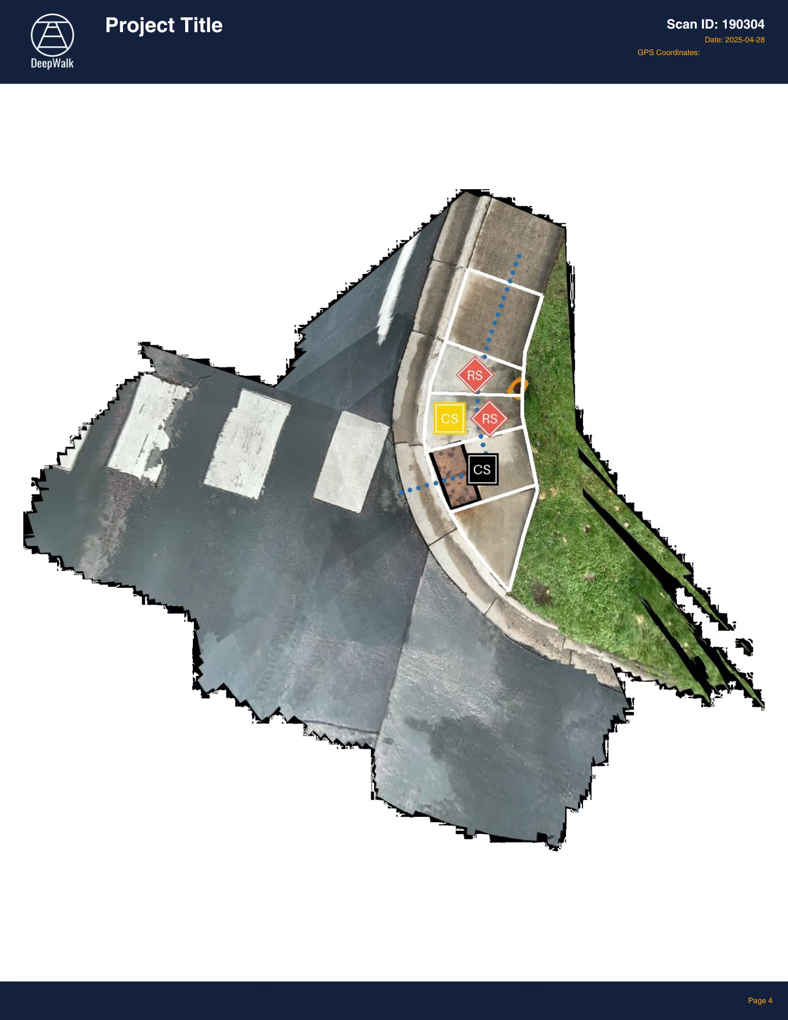
The labelled image is a "birds eye view" of the scanned region indicating the location and severity of identified access barriers
Complete with two case studies, see how to transform your sidewalk and sewer data into one connected, map-ready view. Learn how DeepWalk uses iPhone LiDAR and how PipeAid uses CCTV to capture accurate data quickly.
Hear from department directors at Edina, MN and Upper Arlington, OH on their experience.

Click to download file as a PDF displaying all pages
.avif)
DeepWalk is the sidewalk inspection solution trusted by 120+ municipalities and consultants nationwide.
© 2026 DeepWalk Research, Inc.
All rights reserved.