


2-Click ArcGIS Integration
Get pre-formatted ArcGIS deliverables within 15 minutes using our Esri ArcGIS Integration. This saves GIS teams hours on styling base map layers, freeing up valuable time for project-specific customization.
Explore our library of ArcGIS how-to videos!Map Service
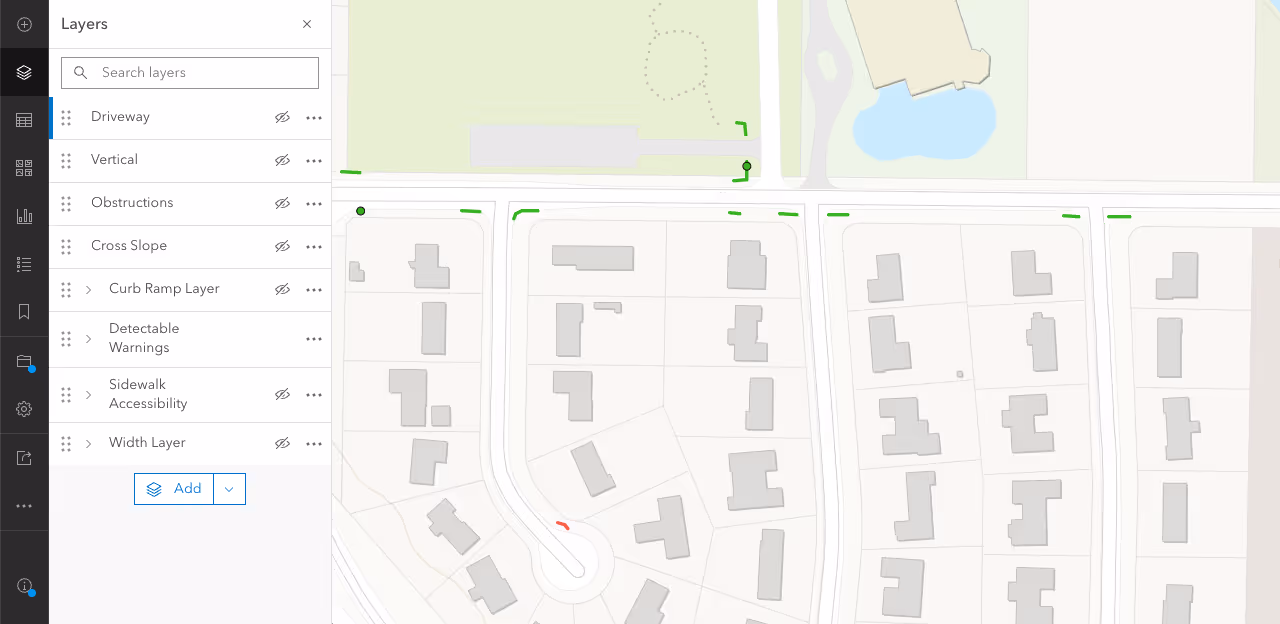
DeepWalk's Map Service breaks down the Feature Service into specific layers highlighting the various sidewalk data points your organization needs. Directly import this service into other ArcGIS mapping applications.
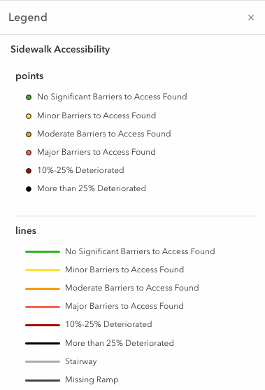
Sidewalk Accessibility Layer
View accessibility score for each sidewalk and curb ramp
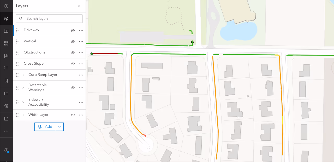
Cross Slope Layer
View cross slope violations exceeding the maximum of 2%
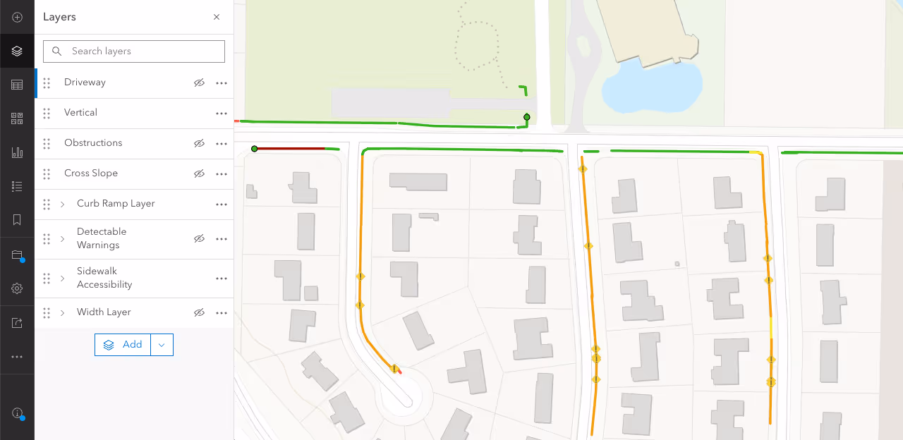
Curb Ramp Layer
View curb ramp locations with assigned accessibility score

Detectable Warning Surfaces
View the status of detectable warning surfaces
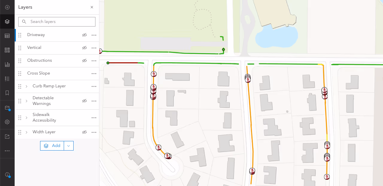
Driveway Layer
View tagged driveway locations within the sidewalk network
Obstructions Layer
View identified obstructions within the sidewalk network
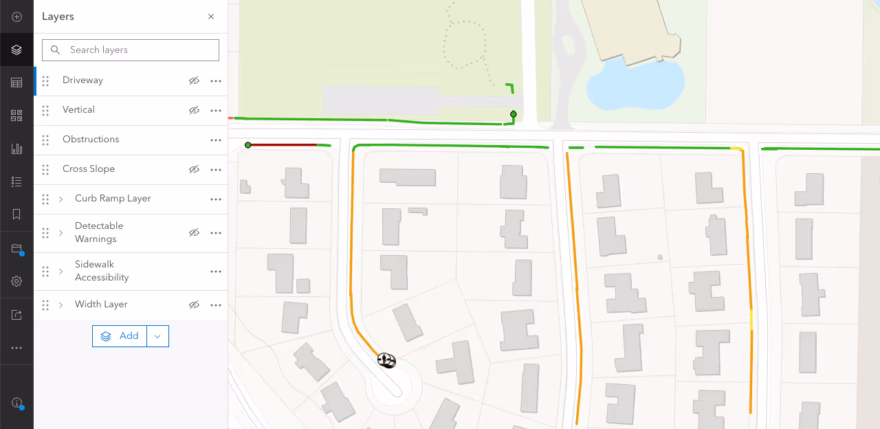
Vertical Displacements Layer
View tagged vertical displacements within the sidewalk network
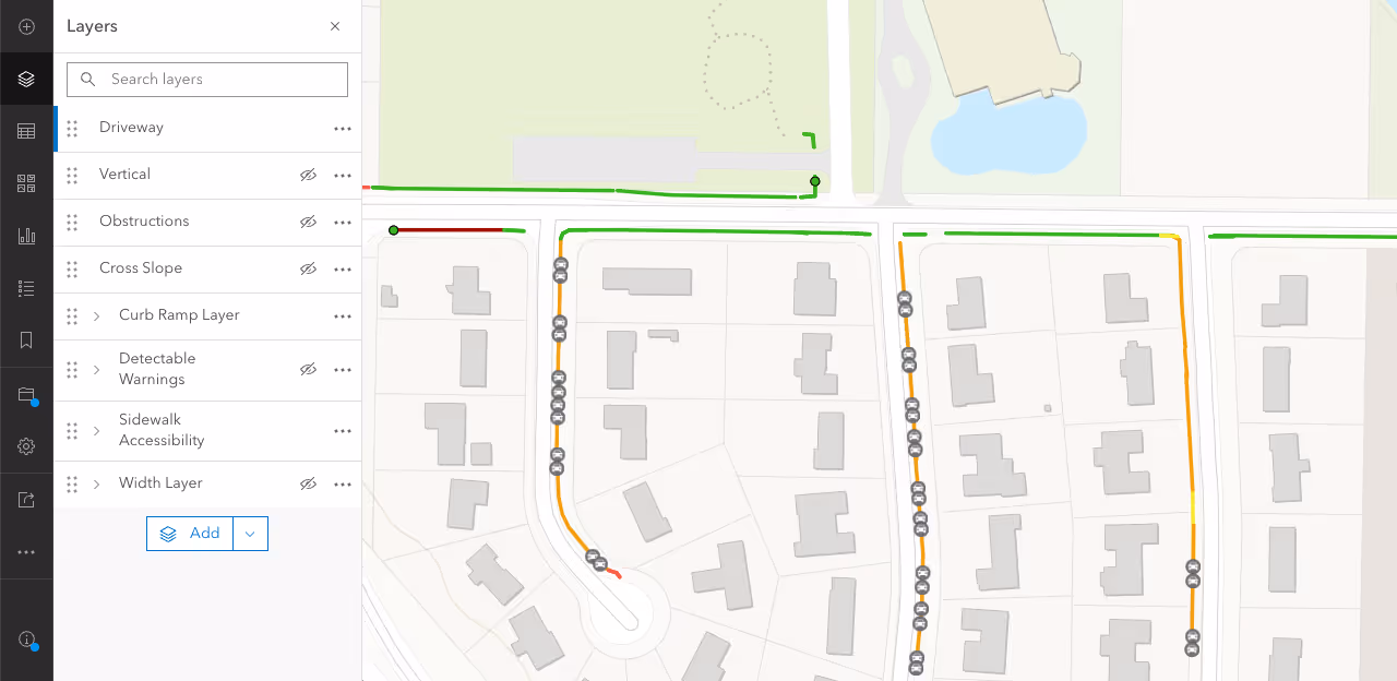
Sidewalk Width Layer
View sidewalk and curb ramps that do not meet the minimum clear width requirement of 36"
Feature Service
Easily integrate sidewalk inspection data into all of your organization's ArcGIS mapping services using DeepWalk's Standard Feature Service
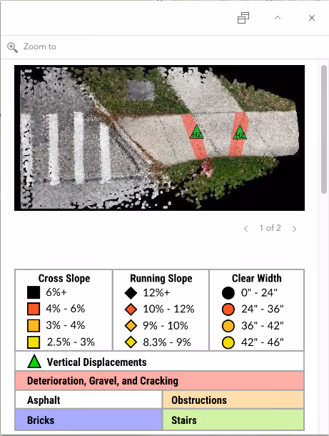
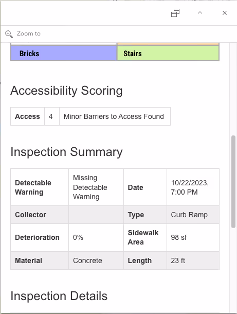
Custom ArcGIS Pop Up Highlighting Important Data Points
DeepWalk's Feature Service comes with a prebuilt pop up that allows for the layer to be added to existing maps with minimal formatting.
.avif)
Automatic Mapping Updates
To ensure that sidewalk data remains current across multiple ArcGIS maps and applications, manual updates for each map are typically required. However, this process can be time-consuming and costly. This often results in new sidewalk inspection data never making it to your organization's mapping applications and the expensive sidewalk dataset quickly becoming unreliable.
DeepWalk's Feature Service is automatically updated with the latest sidewalk data after each collection project. By using this service, your organization can effortlessly incorporate sidewalk inspection data into all relevant ArcGIS mapping products as a Feature Layer. This eliminates the need to individually update each service, saving valuable time and resources. With DeepWalk's Feature Service, you can guarantee that all your ArcGIS products contain the most up-to-date information, without overwhelming your busy GIS team.
Ready to Use Styling
DeepWalk's Feature Service data points come styled for immediate use. Points come in a stoplight color scheme with green being the most accessible and red being least accessible. This allows GIS teams to quickly add sidewalk Feature Layers to their existing maps without spending time on the tedious styling process.
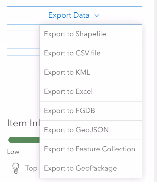
One Click File Exports
Easily export your sidewalk data into 8 different mapping file formats to use your DeepWalk data in any mapping platform
Supported File Formats:
- Shapefile
- CSV
- KML
- Excel
- FGDB
- GeoJSON
- Feature Collection
- GeoPackage
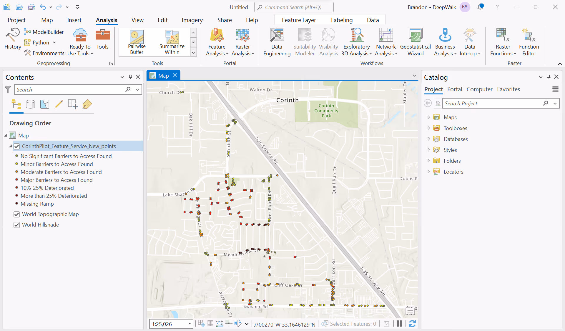
Import into ArcGIS Pro for Advanced Analysis
Quickly import into ArcGIS Pro for advanced processing and analytics, then propagate the results to all of your ArcGIS products and applications
.avif)
DeepWalk is the sidewalk inspection solution trusted by 120+ municipalities and consultants nationwide.
© 2026 DeepWalk Research, Inc.
All rights reserved.