

Complete with two case studies, see how to transform your sidewalk and sewer data into one connected, map-ready view. Learn how DeepWalk uses iPhone LiDAR and how PipeAid uses CCTV to capture accurate data quickly.
Hear from department directors at Edina, MN and Upper Arlington, OH on their experience.

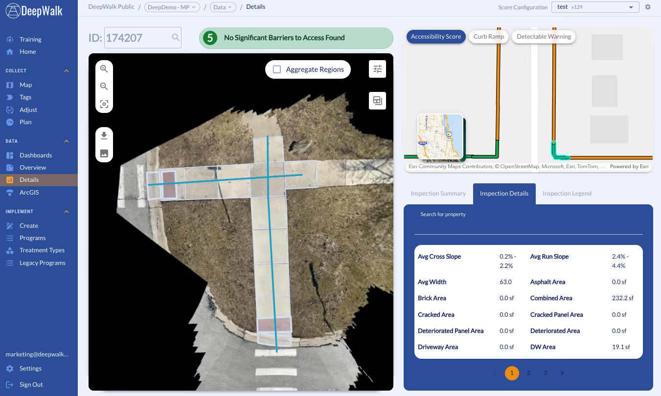
DeepWalk Core is made for municipalities, engineers, and consultants running ongoing sidewalk maintenance programs. It goes beyond the basics to deliver automated widths, areas, ramp types, dectectable warning surface detection, and more within one platfor, our web app. Get the tools you need to automatically identify gaps in your network, common deficiences, and precise locations to prioritze first.
Core turns raw scan data into actionable maintenenace priorities without the manual overhead.

Panel conditions, obstructions, and ramp details are measured automatically, removing the need for manual data entry after inspections
.avif)
Scans are processed and available in your web application 90-minutes after upload, keeping your field crews and office teams moving at the same pace
.avif)
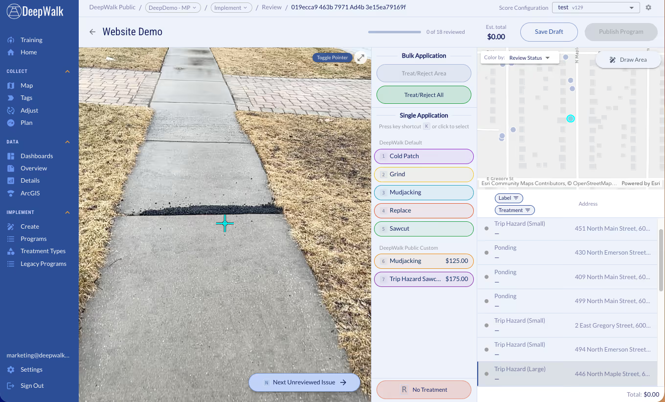
Turn identified barriers directly in work orders and improvement plans from our web app, so your team can move from assessment to repair fast

Every scan includes first-person street-level images alongside the top-down view, giving your team full visual context to determine the fix
Map the current sidewalk mileage in your city, town, neighborhood, or custom area. Our new mileage tool pulls accurate sidewalk information, allowing you to plan efficiently, budget effectively, and determine the amount of data collectors for your project. The data is sourced from OpenStreetMap, a free, collaborative mapping platform built and maintained by contributors worldwide.
Get A Free Mileage Estimate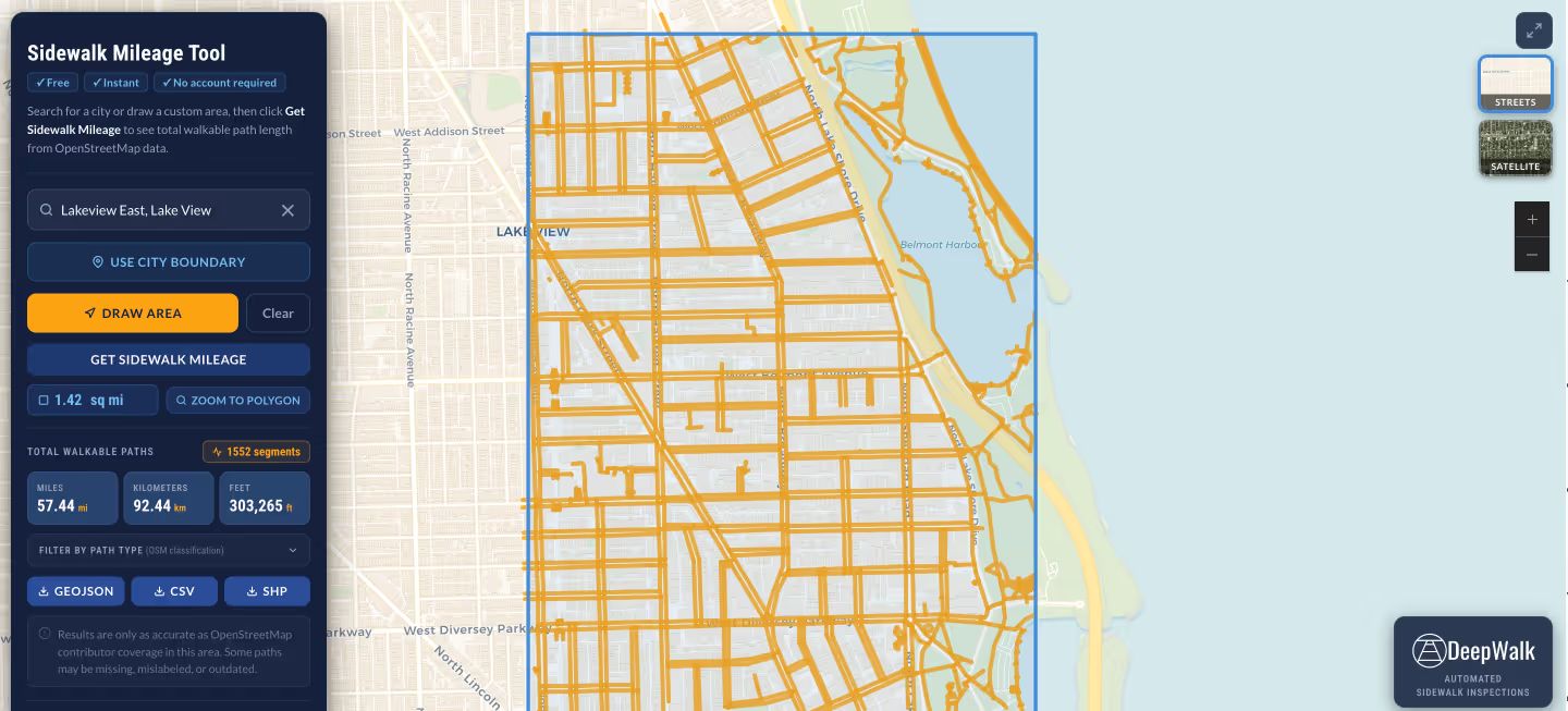

"DeepWalk has made developing ADA transition plans so much easier and consistent. The tool has allowed us to develop more in-depth information for cities that are developing their plans and given us easy-to-use dashboards for project evaluation and development."
Don Kostelec
Principal, Vitruvian Planning

"As a professional transportation data collection firm named "Quality Counts," we take our commitment to quality very seriously. We rely on DeepWalk to enable efficient data collection and deliver the quality output our clients require. DeepWalk allows us to scale efficiently, allowing us to provide our clients with cost-effective PROW/ADA data collection solutions."
Jay McComb
Senior Principal, Quality Counts

"DeepWalk exponentially increased the speed in which we can identify compliant versus non-compliant pedestrian facilities. With very little training, our operator was able to scan at nearly a walking pace. This replaced a very slow, manual process of tape measures, levels, and clipboards to document existing conditions."
Chad Millner
Director of Engineering - Edina, MN
"I'm super pumped. I don't see a city of our size being able to develop a sidewalk maintenance program with the staffing we have, and actually be proactive, without a software like DeepWalk."
Lucas Smith
Director of Public Works - Genoa, IL

"DeepWalk has allowed us to assess pedestrian facilities in a more efficient manner. In addition to cost savings, it also limits our field crews exposure to vehicular traffic, increasing safety."
Travis Helmkamp
Project Manager, Oates Associates

“We were very happy with the efficiency of the DeepWalk tool. Every municipality we work with uses GIS, so this system could be replicated across the country with a public sidewalk system.”
Tatum Storey
Accessibility Practice Principal - Operations, WT Group
.avif)
DeepWalk is the sidewalk inspection solution trusted by 120+ municipalities and consultants nationwide.
© 2026 DeepWalk Research, Inc.
All rights reserved.