
Real Improvements
Start With Automated
Sidewalk Inspections
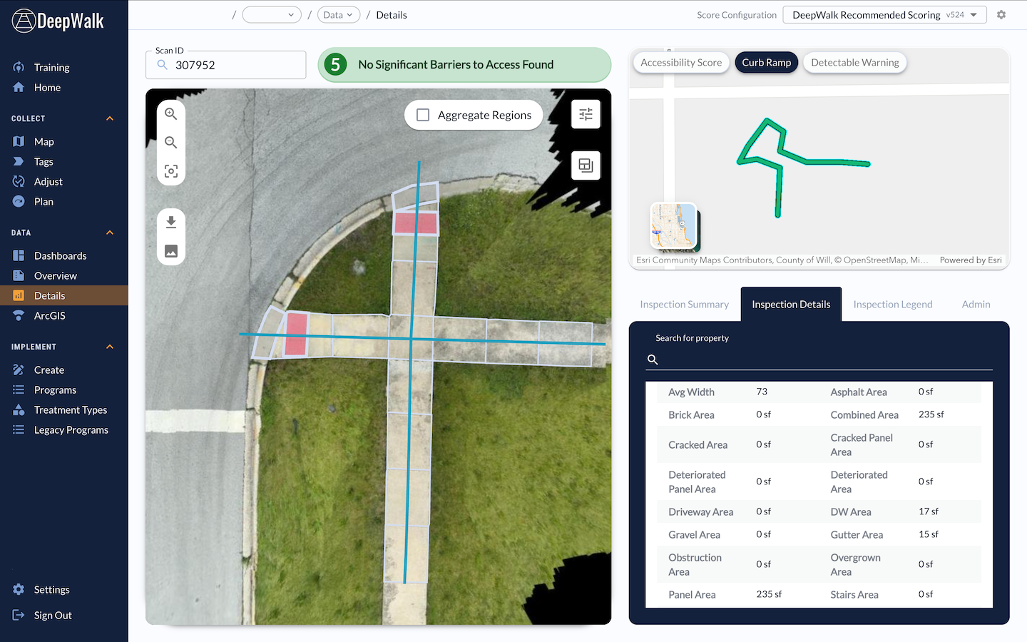
From scan to fix, manage every stage in one platform. Capture access and condition measurements faster with iPhone or mobile LiDAR, from small residential projects to city-wide deployments.
Choose Your Inspection Solution
All plans include the full capability of our mobile app. Download from the Apple App Store.
DeepWalk Core
Best for sidewalk maintenance programs and condition assessments identifying common barriers
$X per month
This includes...

90-minute turnaround
Full web application access
Automated measurements
Work order generation tools
First person imagery

More details
DeepWalk Pro
Best for large sidewalk evaluations and long-term planning projects, requiring slope analysis
Contact us for custom pricing
This includes Core, plus...
Continuous delivery per project size
Full web application access
Run slope analysis
Cross slope analysis
Unlimited users
More details
DeepWalk Drive
Best for city- and county-wide sidewalk projects, requiring vehicle-mounted LiDAR units
Contact us for custom pricing
This includes...
Compatibility with leading sensors
Full network coverage in one pass
Survey-grade inputs for precise data
Continuous delivery per project size
Work order generation tools
More details







Web Application
Web App Access
Full
Full
Full
Delivery Time
90 minutes
Continuous based on project size
Continuous based on project size
Collection Tools
Data Dashboards
Work Order Generation Tools
Transition Tools
Custom Scoring
Measurements and Data
Scan Metadata
Panel Areas
Cracked, Deteriorated, Overgrown Area
Driveway, Stairs, Gutter Area
Brick, Asphalt, Gravel Area
Combined Area
Clear Width
Permanent and Overhead Obstructions
Obstruction Count
Material Type
Average Accessibility Score
Sidewalk Scoring Grade
Custom Data Tags
Run Slope
Cross Slope
Ramp Details
Ramp Type
Detectable Warning Plate Presence
Missing Ramps
Ramp Grade
Images
Top Down Image
First Person Image
Downloads and Integrations
Scan Image Download
AutoReport Download
GeoJSON Export
Work Order Export
ArcGIS Integration
How It Works
2. Upload scans to our automated measurement system
3. Visualize data on our interactive maps and detailed dashboards
4. Generate work orders and efficiently plan sidewalk programs
Estimate your sidewalk mileage before you start
Map the current sidewalk mileage in your city, town, neighborhood, or custom area. Our new mileage tool pulls accurate sidewalk information, allowing you to plan efficiently, budget effectively, and determine the amount of data collectors for your project. The data is sourced from OpenStreetMap, a free, collaborative mapping platform built and maintained by contributors worldwide.
Get A Free Mileage Estimate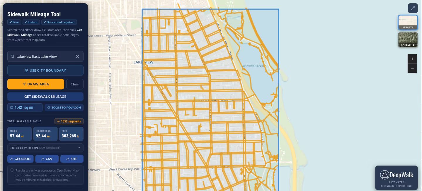
From our users.

"DeepWalk has made developing ADA transition plans so much easier and consistent. The tool has allowed us to develop more in-depth information for cities that are developing their plans and given us easy-to-use dashboards for project evaluation and development."
Don Kostelec
Principal, Vitruvian Planning

"As a professional transportation data collection firm named "Quality Counts," we take our commitment to quality very seriously. We rely on DeepWalk to enable efficient data collection and deliver the quality output our clients require. DeepWalk allows us to scale efficiently, allowing us to provide our clients with cost-effective PROW/ADA data collection solutions."
Jay McComb
Senior Principal, Quality Counts

"DeepWalk exponentially increased the speed in which we can identify compliant versus non-compliant pedestrian facilities. With very little training, our operator was able to scan at nearly a walking pace. This replaced a very slow, manual process of tape measures, levels, and clipboards to document existing conditions."
Chad Millner
Director of Engineering - Edina, MN

"I'm super pumped. I don't see a city of our size being able to develop a sidewalk maintenance program with the staffing we have, and actually be proactive, without a software like DeepWalk."
Lucas Smith
Director of Public Works - Genoa, IL

"DeepWalk has allowed us to assess pedestrian facilities in a more efficient manner. In addition to cost savings, it also limits our field crews exposure to vehicular traffic, increasing safety."
Travis Helmkamp
Project Manager, Oates Associates

“We were very happy with the efficiency of the DeepWalk tool. Every municipality we work with uses GIS, so this system could be replicated across the country with a public sidewalk system.”
Tatum Storey
Accessibility Practice Principal - Operations, WT Group
.avif)
DeepWalk is the sidewalk inspection solution trusted by 120+ municipalities and consultants nationwide.
© 2026 DeepWalk Research, Inc.
All rights reserved.